Mount Ruang eruption, 1,945 residents evacuated from Tagulandang Island
As of Wednesday (1/5/2024) evening, a total of 1,945 residents had been evacuated by boat following the eruption of Mount Ruang.
This article has been translated using AI. See Original .
About AI Translated Article
Please note that this article was automatically translated using Microsoft Azure AI, Open AI, and Google Translation AI. We cannot ensure that the entire content is translated accurately. If you spot any errors or inconsistencies, contact us at hotline@kompas.id, and we'll make every effort to address them. Thank you for your understanding.
By
SAIFUL RIJAL YUNUS
·3 minutes read
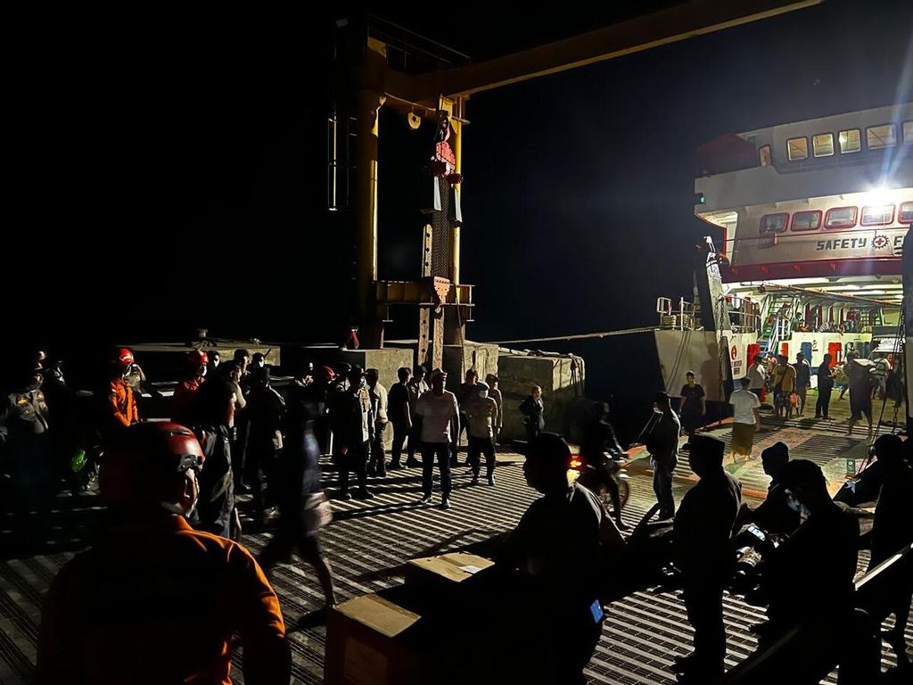
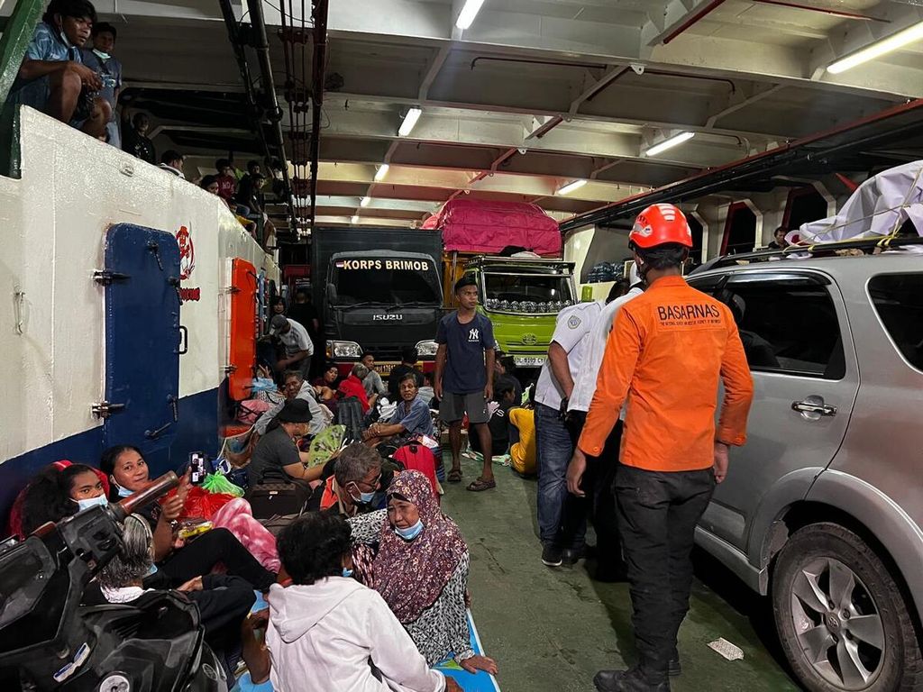
DOK SAR MANADO
A total of 1,945 residents were evacuated from Tagulandang Island, Sitaro Regency, North Sulawesi, until Wednesday (1/5/2024) evening.
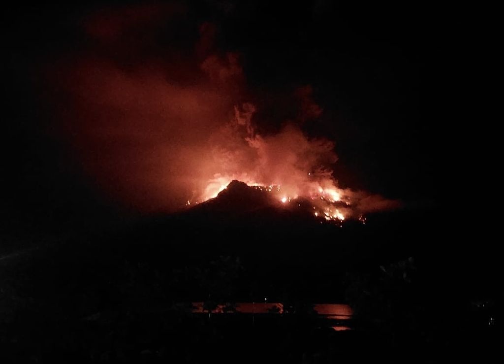
KENDARI, KOMPAS — A total of 1,945 residents of Tagulandang Island, Siau Islands Regency Tagulandang Biaro or Sitaro, North Sulawesi, were evacuated from the island following the eruptionMount Ruang . Gunung Ruang is on another island, separate from Tagulandang, but close to it. The survivors were taken to evacuation locations that were safe from the impact of the eruption. There have been no reports of injuries or fatalities from this incident.
Fery Ariyanto from the Public Relations Section of the Search and Rescue (SAR) Office Manado said that as of Wednesday (1/5/2024) evening, a total of 1,945 people had been evacuated from Tagulandang Island. They were taken to a number of nearby evacuation locations to avoid the eruption of Mount Ruang.
"The residents were evacuated using various ships provided by cross-agency institutions. Based on a temporary assessment, the majority of the residents are in good condition, with only a few elderly residents who are actually ill," said Fery, reached by phone from Kendari, Southeast Sulawesi, on Thursday.
The evacuation of residents, he continued, took place with the hard work of various agencies. For example, KN SAR Bimasena evacuated 109 people. Meanwhile, KRI Kakap carried 453 people, KMP Lohoraung 663 people, and KMP Lokongbanua evacuated 720 people.
Rescue and evacuation operations will continue in line with the ongoing eruption. Residents will be brought to the harbors of Siau, Likupang, or Manado and Bitung.
A total of 109 residents of Tagulandang Island in Sitaro Regency, North Sulawesi, were evacuated to Likupang Regency using the KN SAR Bimasena. The eruption of Mount Ruang continues to occur and has also resulted in the cessation of flights.
"At the present time, eruptions are still occurring with minor explosions and smoke only. Although the situation is not like it was a few days ago, high alertness continues to be maintained," he said.
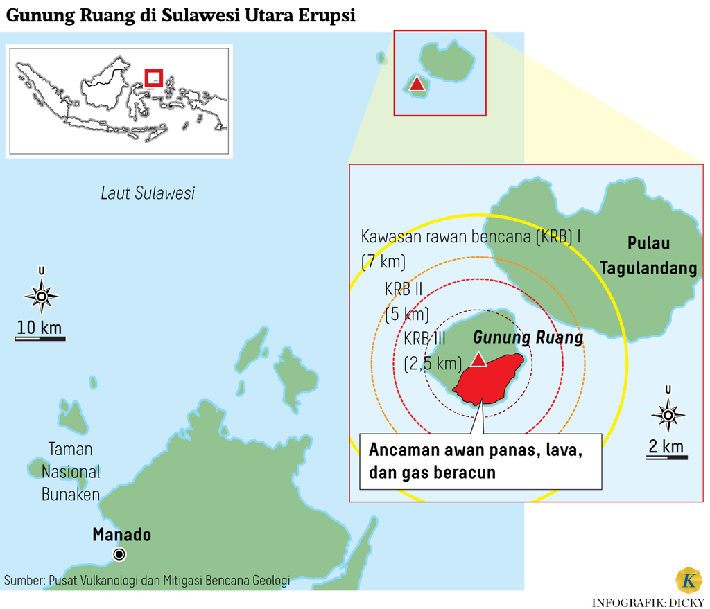
Mount Ruang's status has been raised to Alert as of April 30th, 2024 at 01:30 Wita. Residents within a 7-kilometer radius of the crater, especially on the west coast of Tagulandang Island, are urged to evacuate to avoid potential impacts of the eruption.
The increase in volcanic activity is apparent from the high number of shallow and deep volcanic earthquakes since Monday (29/04/2024). Based on records from the Center for Volcanology and Geological Disaster Mitigation (PVMBG), on that day from 00:00 to 24:00 Wita, there were 15 tectonic eruption earthquakes, 237 shallow volcanic earthquakes, 425 deep volcanic earthquakes, 15 local tectonic earthquakes, and 6 distant tectonic earthquakes recorded.
When contacted separately, Acting Regent of Sitaro Joy Oroh conveyed that residents were directed to stay away from the eruption center and temporarily evacuated. Several ships were prepared for residents who wanted to leave the island for another island.
"In Siau, there are seven evacuation center points. In Manado and Bitung, the government has also prepared locations. So, if there is a need, it will be addressed directly. So far, there have been no reports of casualties," he said.
Based on data, there are 22,000 people living on Tagulandang Island. They are spread across 30 villages in three districts on the island. However, some of them go to school or work elsewhere.
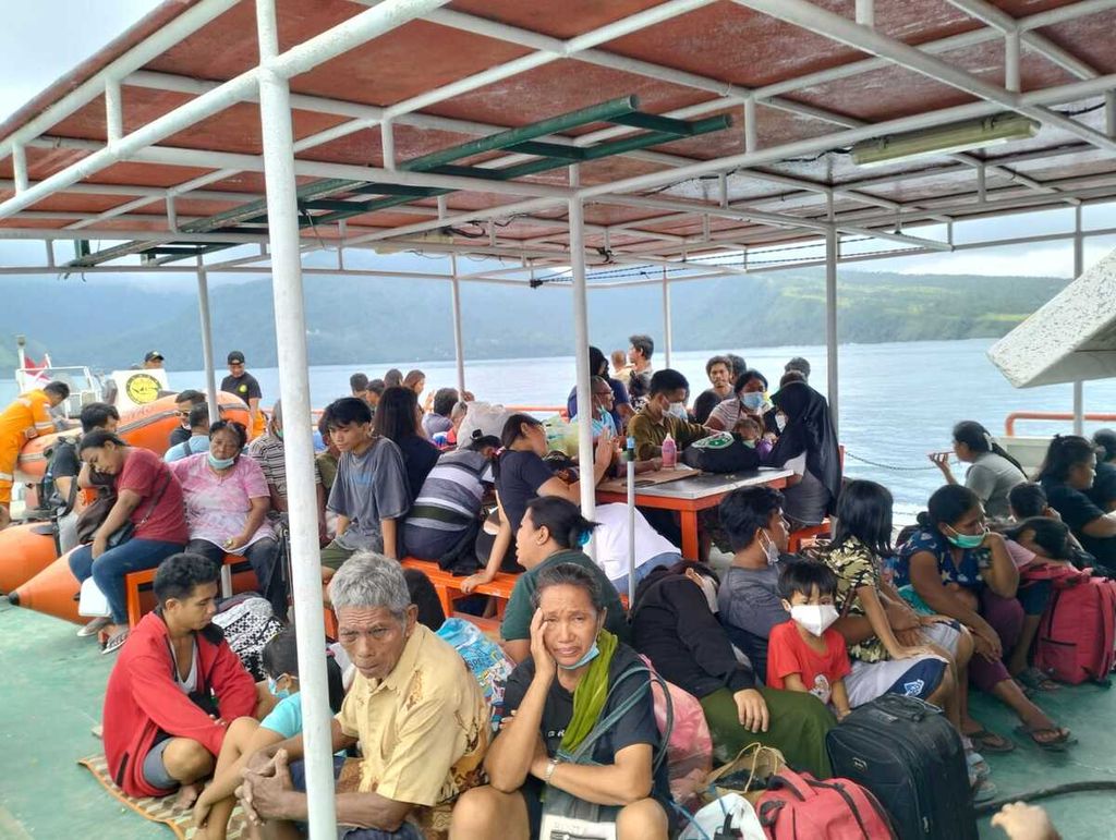
DOKUMENTASI BPBD SITARO
The eruption of Mount Ruang in Sitaro Regency, North Sulawesi, occurred on Tuesday (16/4/2024) evening. Hundreds of residents were evacuated.
"As per the instructions from the governor, who has ordered the evacuation of residents who wish to leave the island, we have prepared a sea vessel. Today, there is a pioneer ship from the navy, SAR, and other agencies. All teams are continuously working," he said.
In determining the "Alert" status in Mount Ruang's previous eruption period, from April 17-22, 2024, a sterilized area was defined within a 6-kilometer radius from the center of the crater. In this current eruption, 5,430 refugees are recorded scattered in several villages. Two of them, Pumpenta Village and Laing Patehi Village, are located in the foot of Mount Ruang.
"For the sterile area, we have extended it to 7 kilometers because the material projection reaches that radius. This condition also has an impact on the potential increase in the number of refugees. However, for certainty, we are still waiting for data from the National Disaster Management Agency (BNPB). Based on information on the ground, many residents have already evacuated independently," said Hetty Triastuty, a mid-level researcher at PVMBG, in Bandung, West Java on Tuesday (30/4/2024).
Along with the eruption of Mount Ruang, flight activities have also been paralyzed. The operation of Sam Ratulangi International Airport has been temporarily suspended from Tuesday until Thursday (2/5/2024) noon. The airport's reopening awaits a cross-agency coordination meeting.
DOK SAR MANADO
A total of 1,945 residents were evacuated from Tagulandang Island, Sitaro Regency, North Sulawesi, until Wednesday (1/5/2024) evening.
Editor:
NELI TRIANA
Share
Kantor Redaksi
Menara Kompas Lantai 5, Jalan Palmerah Selatan 21, Jakarta Pusat, DKI Jakarta, Indonesia, 10270.
Tlp.
+6221 5347 710
+6221 5347 720
+6221 5347 730
+6221 530 2200
Kantor Iklan
Menara Kompas Lantai 2, Jalan Palmerah Selatan 21, Jakarta Pusat, DKI Jakarta, Indonesia, 10270.